Stronsay’s unique shape earns its title as Orkney’s “Isle of Bays”, with narrow strips of land separating the island’s three largest bays: St Catherine’s Bay to the west, Mill Bay to the east, and Bay of Holland to the south.
An oasis of calm
Introduction
Stronsay’s unique shape earns it the title Orkney’s “Isle of Bays”, with narrow strips of land separating the island’s three largest bays: St Catherine’s Bay to the west, Mill Bay to the east, and Bay of Holland to the south. The island’s main industries are reflected in its Old Norse name “Strjónsey”, meaning a good place for fishing and farming.
Herring
Stronsay’s main settlement, Whitehall, is notable for its substantial buildings that hint at a prosperous past. Stronsay was Orkney’s most important fishing port during the herring boom of the late 19th and early 20th centuries and a flourishing herring fishing industry brought prosperity to Whitehall as a vibrant hub for fish-processing activity. At the industry’s peak there were over 1,000 inhabitants on the island while the population swelled to a workforce of 5,000 during the fishing season. With up to 300 fishing boats moored in Whitehall it was said that a person could walk from boat to boat right across the harbour without touching the water.
The First World War brought the herring trade to a standstill and herring catches declined. The outbreak of the Second World War in 1939 marked the final collapse of the herring industry from which it never recovered. One of the last visible relics of the herring boom is the concrete wreck of A.C.W.11, a coal barge which ran aground in 1936 at the entrance of the Bay of Franks, less than 2 km from Whitehall.
Bay of Franks and the coal barge wreck
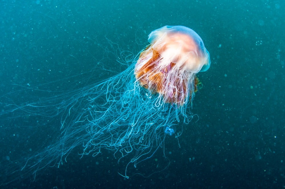
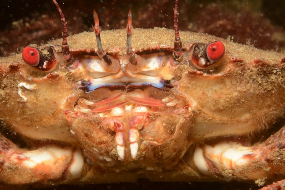
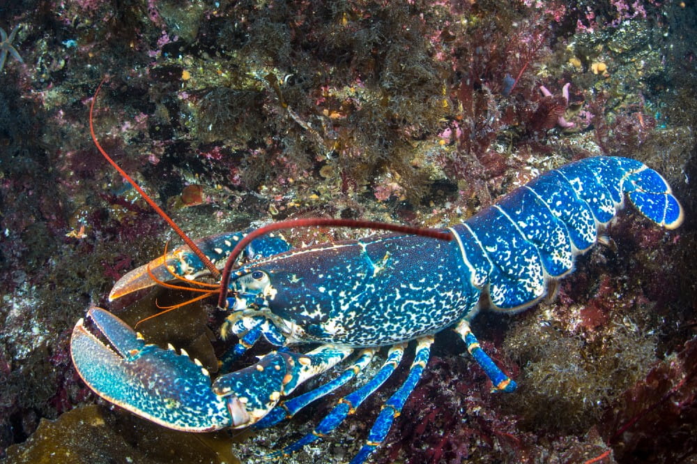
The extensive shallow waters of the Bay of Franks contain a spectrum of habitats that support many fish species, crab, lobster and sea mammals such as seals and otter. Protected from strong wave action, the bay’s stands of seaweed have become particularly well developed, forming an extensive mosaic of seaweeds separated by patches of sediment.
The wreck of the A.C.W.11 coal barge provides an opportune structure for artificial reef development in the middle of the bay. It is covered by a rich community of encrusting animals and seaweeds and attracts shellfish and shoals of fish.
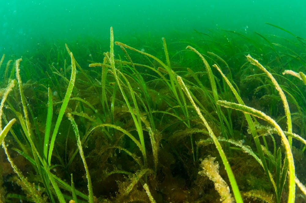
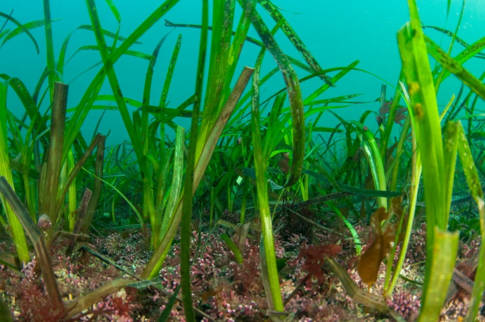
Seagrass beds
Seagrass beds (Zostera species) are found in sheltered, sandy bays around Stronsay, including the Bay of Franks. Locally called “mella” or “mallow”, this seagrass is one of very few types of marine flowering plants. The seagrass roots bind and stabilise the sediment, helping to prevent seabed erosion. The beds enhance biodiversity by providing a sheltered habitat for a variety of marine creatures including the pipefish, and are used as nursery areas by commercially important species such as crabs, flatfish and pollack. Seagrass beds are recognised in national and international conservation lists, as well as in Orkney’s Local Biodiversity Action Plan, reflecting their vulnerability and importance as a marine habitat.
Oyce of Huip
The north-western side of the Bay of Franks is connected to a coastal lagoon, the Oyce of Huip. This inner lagoon is separated from the larger bay by a spit of rock and shingle that nearly encloses the entrance of the Oyce, leaving a narrow channel only 40 m wide. As the tides rise and fall, water flows through this channel enhancing the tidal currents. The species found here thrive in the faster flowing water, including mermaid’s tresses (locally called “madroo”), strands of sea oak carrying many other attached organisms, and velvet horn seaweed, which is relatively uncommon in Britain. The inner area of the Oyce is a much more tranquil environment, where a forest of knotted wrack flourishes.
Snorkelling
The sheltered and shallow waters (most less than 5 m deep) of the Bay of Franks and its neighbouring inlet, the Oyce of Huip, provide excellent snorkelling opportunities. These include mixed shallow seabed areas in the outer bay and approaches to the A.C.W. 11 wreck site, the wreck itself, shallower waters at the entrance to the Oyce and the ultra-sheltered waters further within.
External resources
- Both Orkney and Shetland took part in the historic herring boom. Click to learn more about the rise and fall of the historic industry from the Shetland Maritime Heritage Project
- Learn more about the wreck of the coal barge A.C.W.11 in Historic Environment Scotland’s Canmore database
- Many words for natural features derive from Old Norse and are usually descriptive, based on the appearance or position of the feature. Local heritage website Orkneyjar lists the Norse and rough translations of these features
- NatureScot is Scotland’s nature agency with 30 years’ experience advising the Scottish Government, working in part to engage people with their natural surroundings. Click to access NatureScot’s page on seagrass bed habitats
- Marine Scotland’s 2020 commissioned study “Blue carbon audit of Orkney waters”, led by Heriot Watt University, represents Scotland’s first regional assessment of blue carbon resources. Click to view the report
- The Orkney Local Biodiversity Action Plan (LBAP) 2018-2022 seeks to maintain the quality of seagrass beds in Orkney and prevent their deterioration. Click to learn more about the LBAP’s targets for seagrass beds
Community
- Stronsay’s tourism website provides detail for visitors on the island’s various attractions and facilities
- The Stronsay Development Trust works to promote the sustainability of the small population of around 350 residents by gathering their ideas, identifying projects, and turning these into fully realised community assets. Click to learn more about their activities
- Although Orkney is rich in its folklore, Stronsay is famed for the historical sighting of the 55-foot-long “Stronsay beast”, washed up on its shores in 1808. To date the true nature of the beast remains unknown. Read about the mystery on Orkneyjar