Rising only 23 m above sea level, North Ronaldsay is the northernmost of the North Isles.
Treacherous waters and hidden shipwrecks
Introduction
North Ronaldsay is the most northern and isolated of Orkney’s North Isles. The island is just 5 km long and very flat, rising to only 23 m above sea level. It is exposed to the uninterrupted power of the ocean in all directions except its south westerly quadrant, where the other islands of Orkney afford it some protection. Old traditions of dialect, music, stories and crafts continue to thrive amongst the 80 or so residents of North Ronaldsay and visitors are drawn to the island’s cultural, built, and natural heritage. One famous landmark, a listed historic monument, is the “sheep dyke”, a drystone wall encircling the island. It was completed in the mid-19th century to restrict North Ronaldsay’s native sheep mainly to the foreshore, away from the prime farmland. These rare breed sheep have become adapted to a diet based predominantly on seaweed instead of on grass. North Ronaldsay is also renowned amongst birdwatchers for its diverse array of spring and autumn migrants and frequent rarities. The island’s isolated geography provides a staging post for birds migrating north or south between their breeding and wintering grounds, and a resting place for vagrant birds blown off course from their usual migration routes. The North Ronaldsay Bird Observatory was established in 1987 to study and record the island’s rich avian diversity.
Sea conditions, mapmaking and lighthouses
The seas around North Ronaldsay are in almost constant motion due to the island’s exposure to waves and swell. As the tide ebbs and flows between the Atlantic Ocean and the North Sea, strong tidal streams form off of either end of the island. These relentless waves and churning tides combine to create dangerous waters for shipping and small boats.
Over the centuries, shipwrecks have been a regular occurrence around the North Isles, and particularly around North Ronaldsay and its nearby shallow rocky reefs and skerries. The Reef Dyke skerry was particularly hazardous, and caused the catastrophic wreck of the Swedish East Indiaman vessel Svecia in 1740. Following this event, Orkney-based cartographer Murdoch Mackenzie produced the first accurate chart of the coastline around North Ronaldsay. His work revolutionised mapmaking, establishing standards which were not surpassed until the development of the modern admiralty chart.
As Orkney’s most northerly land mass, low-lying and surrounded by navigational hazards, North Ronaldsay was one of the first sites in Scotland to merit a lighthouse. The historic Old Beacon at Dennis Head, completed in 1789, is the oldest surviving purpose-built lighthouse tower in Scotland and a nationally important scheduled monument. A new lighthouse was built in 1852, twice the height of the Old Beacon and, at 42 m, the tallest land-based lighthouse in the UK.
Shipwrecks and diving exploration
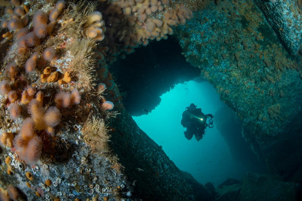
Wreck-diving is a major recreational activity throughout Orkney, particularly on Scapa Flow’s famous world war relics, although the North Isles’ seabeds are also home to numerous wrecks. North Ronaldsay’s powerful seas have flattened many of its wreck structures and make diving on the wrecks notoriously difficult. Consequently, to find a suitable place to explore a wreck in detail, our dive team selected the more sheltered waters east of Mill Bay, Eday, where the 32 m military steam tug Oceana lies in 15 m of water. After sinking following a collision with another vessel in 1915, this ship was partially salvaged to remove her armaments, and what was left remains on the seabed in three upright sections.
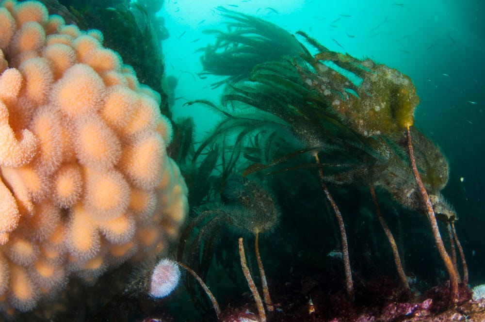
Wreck colonisation and records
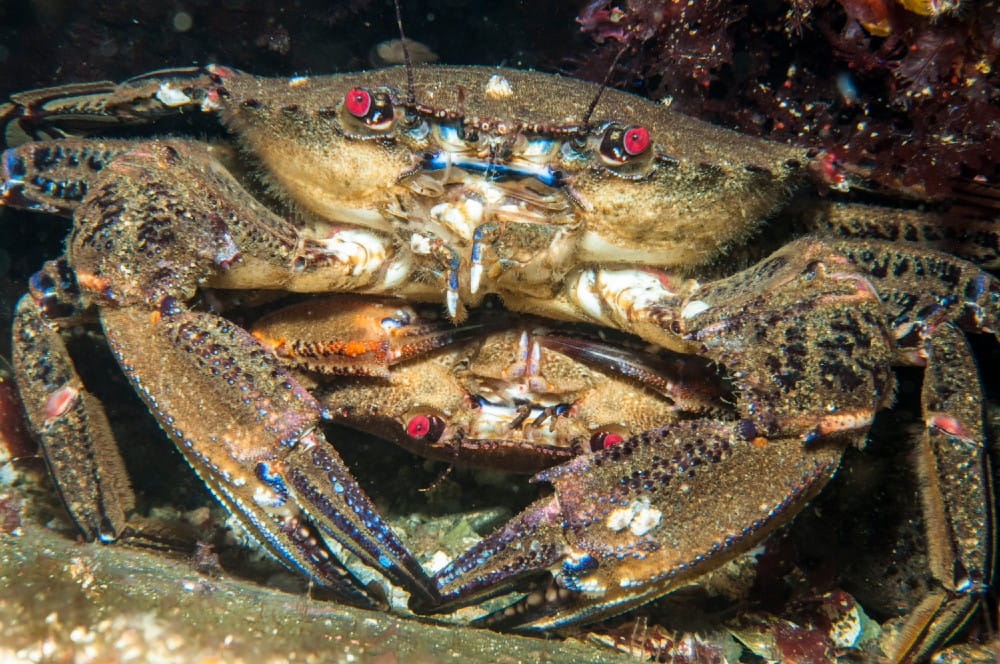
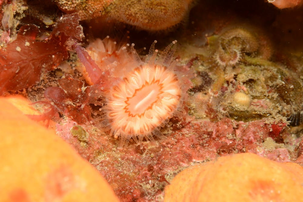
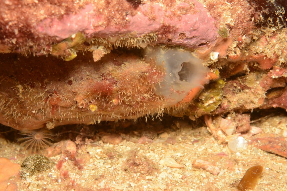
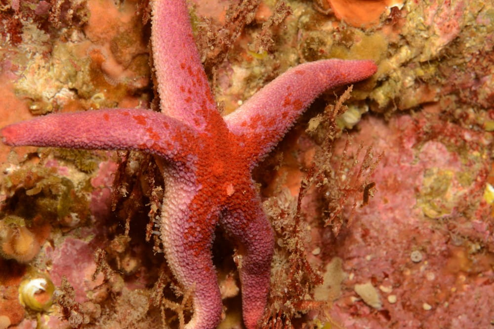
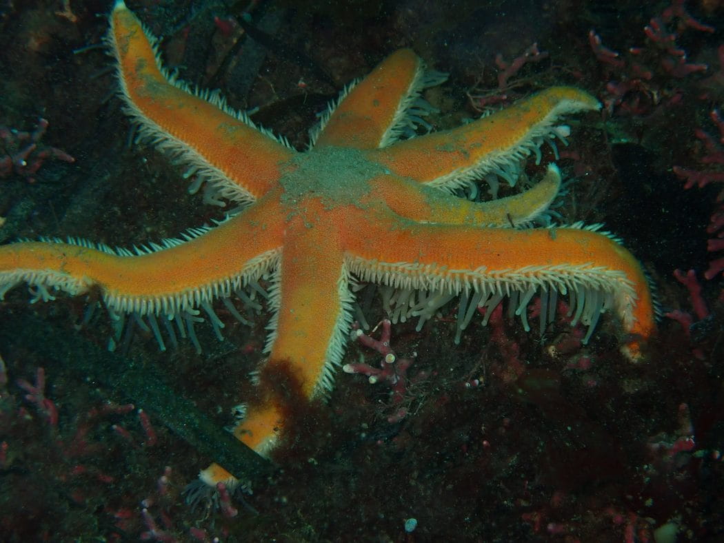
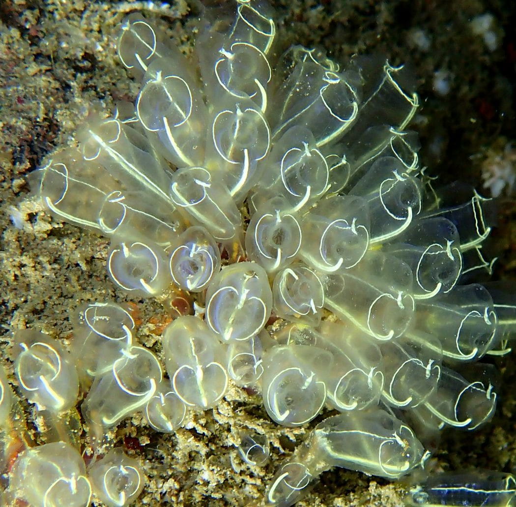
Over time, submerged wrecks become artificial reefs as the ships’ complex structures provide habitat and shelter for a variety of seaweeds and marine creatures, and eventually develop into biodiversity hotspots. In wave and current swept waters like those around North Ronaldsay, wreck sea life can be less diverse, and the aptly named colonial soft coral “dead man’s fingers” often dominate the community, along with barnacles, sea urchins, shellfish and fish. In the less harsh conditions found off Eday, the associated seaweeds and animals growing directly on wreck surfaces are more varied and profuse. This encrusting ‘turf’ includes red seaweeds, sponges, corals, sea squirts, and colonial animals known as hydroids and bryozoans. More mobile animals including crabs, sea urchins, colourful starfish, and fish such as wrasse and pollock are, in turn, attracted to the shelter and feeding opportunities afforded by wrecks.
Orkney’s shipwreck habitats are treasured for both their archaeology and marine life by local, visiting recreational and scientific diving communities. Documenting historic wrecks and the rich communities of sea life they support is an ongoing activity, involving close collaboration between researchers and volunteer divers.
External resources
- Learn more about North Ronaldsay’s ancient breed of seaweed-eating sheep
- Learn more about the wreck of the Svecia, from Historic Environment Scotland’s Canmore database.
- Learn more about the wreck of the HM tug Oceana and other naval wrecks sunk in Orkney waters during the First World War.
- The wrecks of the German High Seas Fleet in Scapa Flow, south of Orkney’s Mainland, are renowned for UK scuba diving. The Scapa Flow Historic Wreck Site provides detailed information and interactive 3D models of each wreck, as well as information on their rich artificial reef ecosystems
- View Andy Jackson’s black & white footage (at 32:15 mins) of a North Ronaldsay wreck dive (in respectful memory of an excellent underwater cameraman)
- The voluntary diver recording group ‘Seasearch’ is an important collaborator in documenting Orkney’s wreck wildlife. Trained volunteers collect species and habitat data with the overarching aim to map out the various types of seabed found in the near-shore zone around the whole of Britain and Ireland. Learn more about Seasearch and their available training events
- NILPS' North Isles Community Wildlife Recording project will encourage recording of wildlife in the North Isles to improve understanding of the known distribution of many plants and animals in the isles. Click to read about the project and how to get involved
Community
- Click to view local information on the Island of North Ronaldsay’s website.
- The North Ronaldsay Trust (NRT) is established to preserve the island’s built and natural heritage for the benefit of the community and public at large, as well as to support locals in areas including wellbeing, housing, and education. Click to read more about their activities
- Visit the North Ronaldsay Sheep Dyke Warden’s website to learn more about the seaweed-eating sheep.
- Maintaining the North Ronaldsay Sheep Dyke is an arduous task. In addition to a full-time ranger, the local community is supported through the annual North Ronaldsay sheep festival, which invites volunteers to work on the Dyke. Click to learn more.
- Learn more about the North Ronaldsay Bird Observatory, which also offers accommodation and a small food shop for its visitors.