Between the north-western tip of Orkney Mainland and the island of Westray lies a cluster of three inhabited islands: Rousay, Egilsay and Wyre.
Sounds of maerl & blue carbon
Introduction
Between the north-western tip of the Orkney Mainland and the island of Westray lie a cluster of three inhabited islands: Rousay, Egilsay and Wyre. All are rich in cultural, natural and archaeological history. Rousay is the largest at 6 km long by 9 km wide. To its east Egilsay is much smaller at 5 km by 2 km, and to the south-east Wyre, one of Orkney’s smallest inhabited islands, is just 3 km by 1 km. An array of important and well-preserved archaeological sites span the Neolithic, Iron Age, Pictish and Viking/Norse periods. The islands and their inshore waters also host a diversity of land and marine habitats and species, many designated for national and international conservation significance. Rousay has a moorland-dominated landscape of terraced and rounded hills, with coastal grasslands and seabird-populated cliffs. In contrast Egilsay and Wyre are greener, low-lying islands covered by fertile farmland and wetlands. The seawater sounds between the islands, never more than 1 km wide or 20 m deep, are swept through by crystal clear tidal currents that typically flow at 2-3 knots in spring tides. The modest flows in relatively shallow waters provide perfect conditions for the growth of unusual seaweeds commonly known as maerl.
Maerl
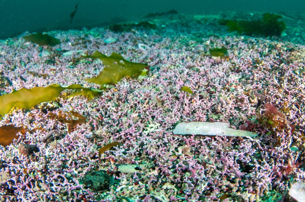
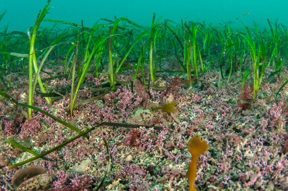
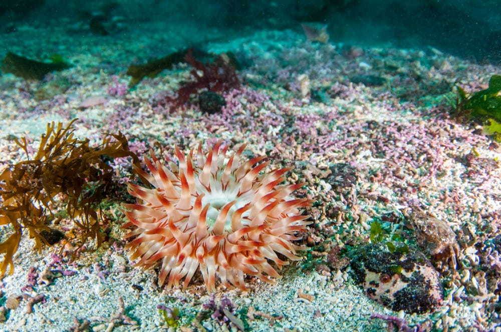
Maerl is the shared name describing species of coral-like red seaweeds that form brittle, chalky skeletons as they grow. These skeletons form intricate branched shapes or nodules and are not attached to the seabed. Live maerl has a pink colour that turns white when it dies. Maerl grows in shallow water, up to 30 m deep, in areas where the water flow is strong enough to remove fine sediments, but is not so strong as to wash away the fragile maerl structures. Inevitably, some maerl will be dislodged by waves and tidal action and sometimes washes ashore on nearby beaches.
Maerl is extremely slow growing, adding only 1-2 mm of length per branch tip per year. As living maerl grows upwards towards the sunlight, dead fragmented skeletal material accumulates below and over time, can form deep beds of maerl deposits. These deposits are known to be 1.2 m thick in Wyre Sound but may extend even deeper. Maerl’s slow growth rate means that these beds could have taken thousands of years to form!
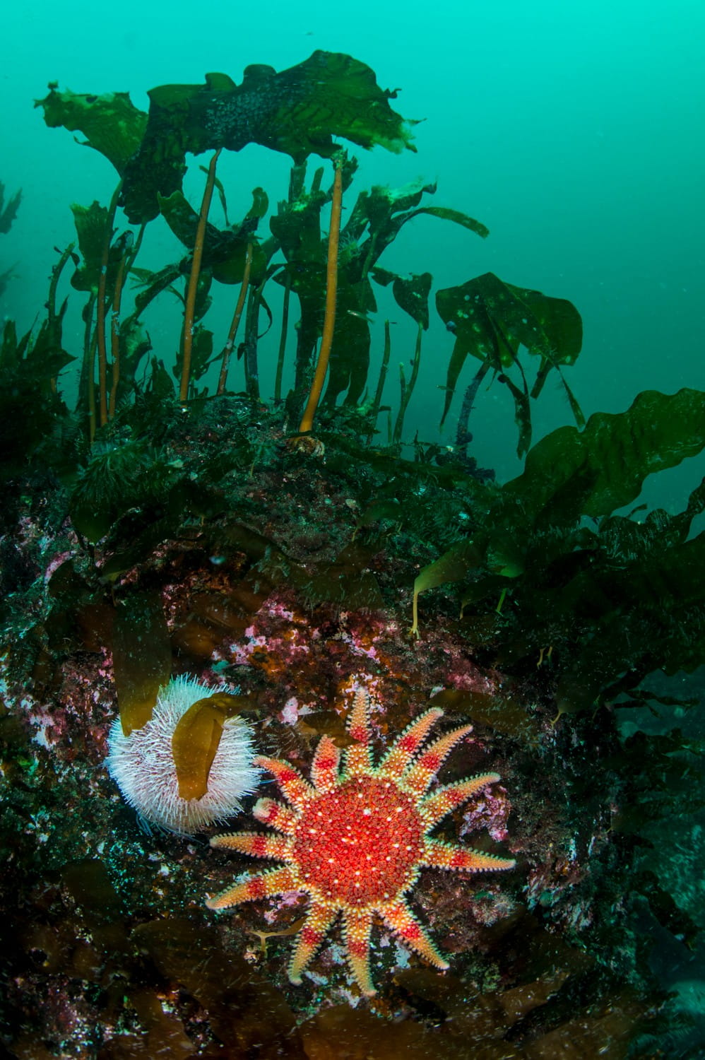
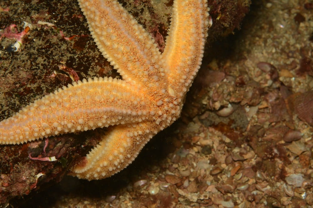
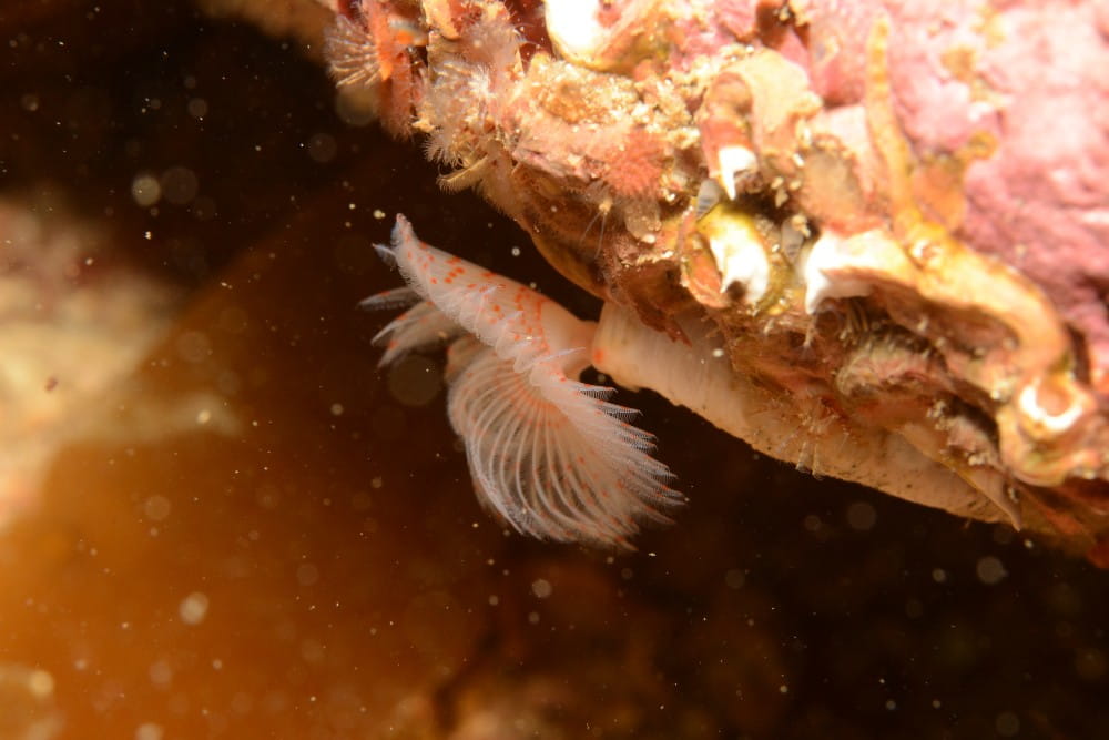
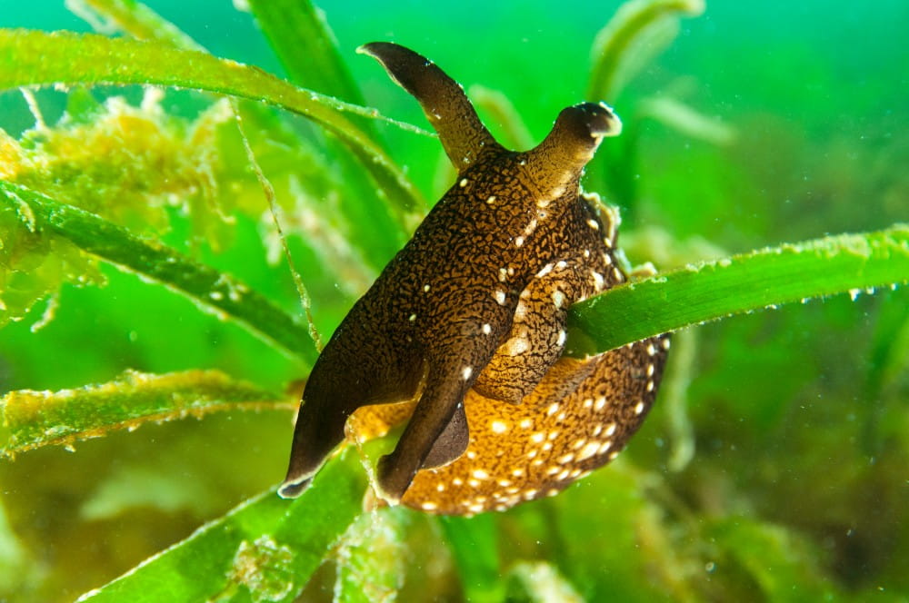
Biodiversity hotspot
The lattice shapes of maerl skeletons create a loose honeycomb-like structure within the maerl bed that provides many nooks and crannies for animals to live or hide in. Spaces in the maerl structure enable seawater to circulate much deeper into the bed than it would in a normal seabed of sand or mud. This combination of an open structure and enhanced waterflow through maerl beds enables many different organisms to live within, burrow into, or attach to the maerl. Maerl beds are often hotspots for biodiversity because of this capacity. Living maerl beds are also important nursery grounds for juvenile scallops and protecting them could help to sustain the scallop fishing industry. The Wyre and Rousay Sounds Nature Conservation Marine Protected Area (MPA) was designated in recognition of the important ecological value of these maerl beds and aims to protect this intriguing and biodiversity-rich habitat.
Blue carbon
The 2020 Orkney Blue Carbon audit estimated 67 million tonnes of blue carbon resource in Orkney, and maerl beds were cited as one of the most important biological carbon stocks, estimated at about 5 million tonnes. The shells, skeletons and tubes of maerl, and the plants and animals living amongst them contain calcium carbonate (CaCO3). As the maerl bed grows the accumulated deposits of carbonate become a natural store or ‘sink’ for atmospheric carbon – a so called ‘blue carbon’ resource. Researchers are currently investigating how managing the blue carbon in maerl beds and other natural carbon stores could help Scotland meet its Net Zero carbon targets by 2045.
The calcium carbonate-rich deposits from Rousay, Egilsay, and Wyre’s seabed habitats provide a rich source of material for Orkney’s coastal habitats including sandy beaches, dunes, and colourful machair grasslands.
External resources
- Marine Scotland’s 2020 commissioned study “Blue carbon audit of Orkney waters”, led by Heriot Watt University, represents Scotland’s first regional assessment of blue carbon resources. Click to view the report
- NILPS' North Isles Community Wildlife Recording project will encourage recording of wildlife in the North Isles to improve understanding of the known distribution of many plants and animals in the isles. Recording any species seen will be encouraged, as well as more focused work on species of special conservation value such as maerl. Click to read about the project and how to get involved
- The voluntary diver recording group ‘Seasearch’ is an important collaborator in the recording of Orkney’s marine wildlife. Trained volunteers collect species and habitat data with the overarching aim to map out the various types of seabed found in the near-shore zone around the whole of Britain and Ireland. Learn more about Seasearch and their available training events
Conservation
- The Royal Society for the Protection of Birds (RSPB) is a conservation charity that manages 13 nature reserves throughout Orkney, including five in the North Isles. Click to learn more about their Trumland reserve on Rousay, as well as:
- Sites of Special Scientific Interest are designations to protect features of land or water that are considered to best represent Scotland’s natural heritage, and many are also designated as SACs or SPAs. Click to learn more
- SiteLink is a resource managed by NatureScot for information and downloads related to conservation designations. Click to explore more information about the Wyre and Rousay Sounds MPA, as well as:
- The Orkney Local Biodiversity Action Plan (LBAP) 2018-2022 identified targets to quantify the blue carbon storage capacity of the Wyre and Rousay Sounds MPA, with the overall objective to maintain the health of Orkney’s maerl beds. Click to learn more about the LBAP’s targets for maerl beds
Community
- Although each of the three islands have their own distinctive character, the Rousay Egilsay & Wyre Development Trust works across the three-island community to tackle local issues and improve the quality of life. Click to learn more about their activities
- Around Rousay provides local news & information, and details of local events on Rousay, Egilsay and Wyre, as well as more information on their heritage sites
- Learn more about some of Rousay’s archaeological sites that make up the “Egypt of the North”, provided by Around Rousay's sister tourism website Discover Rousay
- Learn more about the island of Egilsay from the Egilsay Community Association